Overview
These images were gathered using a DJI Air3 quadcopter starting in 2025. The software running these pages is Zenphoto.
There are images taken in early May 2025 through May 2026. Most of the imaging was done from about 120 m above ground level. Images taken in the spring before the leaves appeared on the trees show clearly the hardwood areas versus softwood areas. In the summer the two are not as easily distinquishable but softwoods are generally a darker green. The summer images are more scenic.
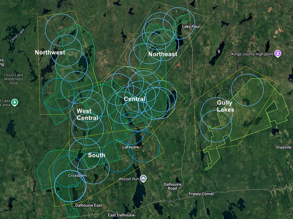
The Gallery has been subdivided into regions of the Chain Lakes Wilderness Area. The regions are shown here outlined with yellow lines. The blue circles indicate a 1.5 km radius from the where the images were taken. Each Album of images has an associated map that shows the geographic location.
All of the images are geo-located by latitude and longitude and the direction of view is given in the title. All direction are azimuth degrees from true north. The resolution of the images here have been reduced by half in height and width to reduce the file size. If you wish a full resolution image, contact the author.
The operator/author is Larry Bogan (larry at bogan.ca)